|
go to top
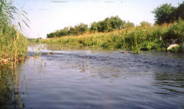
It will be a half day field trip (see an overview map) to explore the Upper Basin of the Biebrza Valley. Several characteristic for the area study sites will be visited during the trip. The description and explanation of the most important and specific features and relationships of the vegetation-soil-water system will be given on site. The trip will be focused on the following aspects:
vegetation:
- characteristic vegetation of calcareous mires (Szuszalewo village, Lipsk vicinity):
- effects of water feeding on vegetation development: calcium indicators, rainwater accumulation on hummocks with bog vegetation in the middle of depression, option: influence of surface water close to the river,
- paleobotanical data, peat borings and stages of mire development,
- influence of management and effects of abandonment (a gradient from managed fen meadows near the houses to abandoned ones further away);
soil:
- characteristics of soil profiles associated with characteristic vegetation;
water:
Collection of hydrological data in wetland areas; groundwater-surface water interaction:
• In the bus: Introductory lecture on Upper Biebrza Basin; geographical, geological and hydrometeorological conditions
• Explanation of the surface water discharge measurements,
• Gauge station Rogożyn village
• Divers, Rogożynek village
• Groundwater-surface water interaction in the headwaters of the Biebrza and its wetlands (Rogożynek village),
• Biebrza River in Lipsk after confluence with Sidra
• Explanation of the groundwater piezometric network in support of ecological gradients analysis (piezometers and divers, Szuszalewo village),
• Importance and methods for positioning and altitude determination in wetlands - Differential GPS and leveling measurements (Szuszalewo village),
• Elevation/water level cross-section in valley - Exercise: Locating piezometers by GPS navigation, measurement of elevation and groundwater levels in piezometers,
• Biebrza River in Sztabin - wetlands vs. transportation needs - where to locate 'via Baltica' highway?
• Biebrza surface water slope and step in slope: geomorphological indicator of Upper Basin outlet
• Biebrza before and after confluence with Augustowski channel
 author: Joanna Kocyba
go to top
It will be a half day field trip (see an overview map) to explore the Lower Basin of the Biebrza Valley. Several characteristic for the area study sites will be visited during the trip. The description and explanation of the most important and specific features and relationships of the vegetation-soil-water system will be given on site. The trip will be focused on the following aspects:
vegetation:
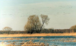
- characteristics of flooded communities on mineral soils: tall sedge vegetation (Magnocaricion) and nitrophilous pastures (Agropyro-Rumicion, Biały Grąd area):
- vegetation structure as a condition for suitable bird habitats,
- characteristics of sedge-moss vegetation near the valley margin (the Tsar road area):
- effects of reed and scrub encroachment,
- paleobotanical data, peat borings and stages of mire development,
- examples of mowing management re-established; discussion of short-terms effects.
soil:
- characteristics of soil profiles associated with characteristic vegetation;
water:
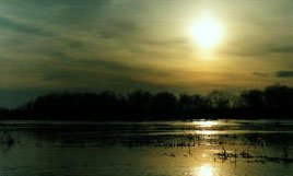
River and wetland, floods and floodplains - relationship and interaction issues
• Floodplain visiting at Biały Grąd area. flood extent, water level, frequency (Biały Grąd area),
• Ecological role of flooding (flood pulse concept, Biały Grąd area),
• Water quality of the Biebrza River (Biały Grąd area),
• Spatial relationship (panorama) of the floodplain and the Bagno Lawki swamp (vicinity of Burzyn village),
• Nature of flood in the Lower Basin: a role of the Narew River and geomorphology on flood duration and forming of the different water types of inundated area (vicinity of Burzyn village),
• Gauge station at Burzyn - measuring of the surface-water stage, relation: water stage and flood extent (vicinity of Burzyn village),
• The Narew River and the valley after junction of the Biebrza river,
• Different water sources of the Bagno Ławki swamp area groundwater and snow-melt/precipitation, (the Tsar road area),
• Water stage fluctuation during inundation period (the Tsar road area).
 author: Sylwia Szporak
go to top
This excursion will be an exploration of part of the Middle Basin of the Biebrza valley (see an overview map). Here we find quite a lot of extensive agriculture leading to some drainage and a significant impact on vegetation. A transect going from the river near Dolistowo Stare in the direction of Kopytkowo will be explored to see the impact of agriculture on the vegetation development. Special attention will be given to the development of tussocks and birch encroachment after cessation of mowing. The excursion will be supplemented by examining of soil profiles developed under different site conditions representing various stages of wetland transformation.
go to top
It will be a half day field trip devoted to presentation of monitoring schemes, measurement equipment and procedures used in data gathering in the wetland areas. The activities will be focused on two fields: soil (including vegetation recording) (site map) and hydrological measurements (site map). The participants will be divided into groups according their interest in particular type of measurements and will practice themselves some of the measurements. The program will be realised at two locations in the Middle Biebrza Basin and will include following aspects:
Field monitoring of:
• soil moisture content (TDR method),
• soil moisture potential (tensiometer method),
• saturated hydraulic conductivity (auger hole and Guelph methods).
Hydrological measurements will be determined in Biebrza River close to Bartek Pension.
They will include three elements:
• determination of the river water velocity and cross-section depth profile - direct measurements of the components of discharge; measurement equipment: OTT current meters;
• measurements of water surface slope - direct surface-water elevation and distance measurements using Differential GPS technology and classical leveling survey instruments;
• discharge and slope post-measurement calculations in the Bartek Pension.
 author: Sylwia Szporak
|
|